Map: Show me the way to AK

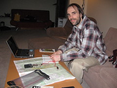
Tailgate Alaska officially kicked off yesterday (7PM AKDT) at mile post 29.5 on Richardson Highway. The bad news for me is that I'm writing about it while sitting in the flat eastern timezone. However, my official departure for AK is not too far off — less than seven days away — so I'm not too bummed about it either. It will give me a bit more time for some last minute preparations before I leave; like securing a good map for example.
 Knowing where you are, and where you have been, are essential in understanding where you are going.
Last year I went all out for Tailgate Alaska and booked three days of heli time. Although it doesn't seem like that much compared to some of the other tailgaters — who ponied up for up to 10 days — it still took me quite some time to save up the scratch to pay for it. One advantage of booking heli time is that you also get the services of a guide who knows his, or her, way around. The guide, being much more familiar with the terrain, will be able to point out hazards and "guide" you to the pick up points. This also means that intimately knowing the area is less of a concern because you can rely on the guide's experience. Therefore the only map I had last year was a road map which can be easily obtained from CAA (sometimes for free when you're a member).
This year I don't have the budget for as much time in the bird as I did last year, so I'm planning to make extensive use of my split board. However, this means that I won't benefit from a guide's experience, making a topo map that much more important. Fortunately, map information is publicly available via Google Maps. The official Tailgate Alaska website has such a map with important features labeled (Python, Berlin Wall, etc). This is useful for getting an rough idea of the "lay of the land", however, a map on the internet is not very useful while in the field. For this a printed map is key.
Natural Resources Canada provides a service to generate topographic maps of any area in Canada. This is a "free" service (well paid for by the Canadian tax payers), which allows you to construct a map at very levels of detail. The map can then be downloaded and brought to a map printing shop (I used World of Maps) to have it printed. Unfortunately, the NRCan Atlas does not allow you to create custom features and way-points. Plus Alaska is not under the jurisdiction of the Canadian Federal Government.
Map Resources
Here are a few resources for those who want to produce their own custom touring maps.
Gratis Maps
- Google Maps: If you don't know about Google Maps, and you still got to this web site, I commend you.
- Natural Resources Canada Atlas: Covers all of Canada
- The National Atlas: Covers all of the United States. The terrain details are a little weak though.
Non-Gratis Maps
- Map Sherpa: Create custom maps with personalised feature labels.
The U.S. Department of the Interior offers the same service with The National Atlas. This allows you to create custom maps for anywhere in the United States, including Alaska. However, I found the level of terrain detail to be lacking, and there is still no capability for custom features and way-points.
Map Sherpa is a commercial service which allows you to create custom maps of anywhere in North America (possibly the world), complete with the ability to add custom features to the map. This is the perfect solution for my mapping needs, however, it's not free like the other solutions. A custom 36x24 inch map will run you $18.99 CDN + Tax for an electronic map (in Adobe PDF format). Bring this map to the printing shop and you have your custom touring map in hand complete with labels of interesting features (i.e. the location of base camp, and the peaks you'd like to bag).
Bombing around Thompson Pass was such a life changing experience that I talk about it constantly (I'm sure my friends are probably getting sick of hearing about it). However, as time passes, I'm finding that I forget specifics like which peak was associated with which run. Being able to mark your runs on a topographical map could make for an amazing conversation piece, possibly even a cool poster to put on your wall to brag to your friends. However, the most important part of a map is to allow you to know where you are, where you're going, and how to find the buried treasure (i.e. the lines you uncover with your snowboard).

